

Empire State Trail/Mohawk-Hudson Bike-Hike Trail
Take in scene views of the Mohawk River, travel the historic streets of Schenectady's Stockade neighborhood, and rediscover the Erie Canal's storied past on the Mohawk-Hudson Bike-Hike Trail.
The Mohawk-Hudson Bike-Hike Trail is a unique recreational and transportation option for Schenectady County locals and tourists. It's a part of New York's 750-mile Empire State Trail and the historic Erie Canalway Bike Trail. The trail starts in Pattersonville, a hamlet in the Town of Rotterdam, and heads eastwards through the City of Schenectady and the Town of Niskayuna before finally entering Albany County.
Take the Trail
- Great Restaurants
- Unique Shoppes
- Outdoor Summer Concerts
- Historic Landmarks
- Beautiful Riverfront Views
The Mohawk-Hudson Bike-Hike Trail is a significant stretch of the Empire State Trail that connects the greater Amsterdam area with the City of Albany's Waterfront. Whether you are starting your adventure on the Empire State Trail, ending your journey, or planning a layover, Schenectady County is the perfect place.
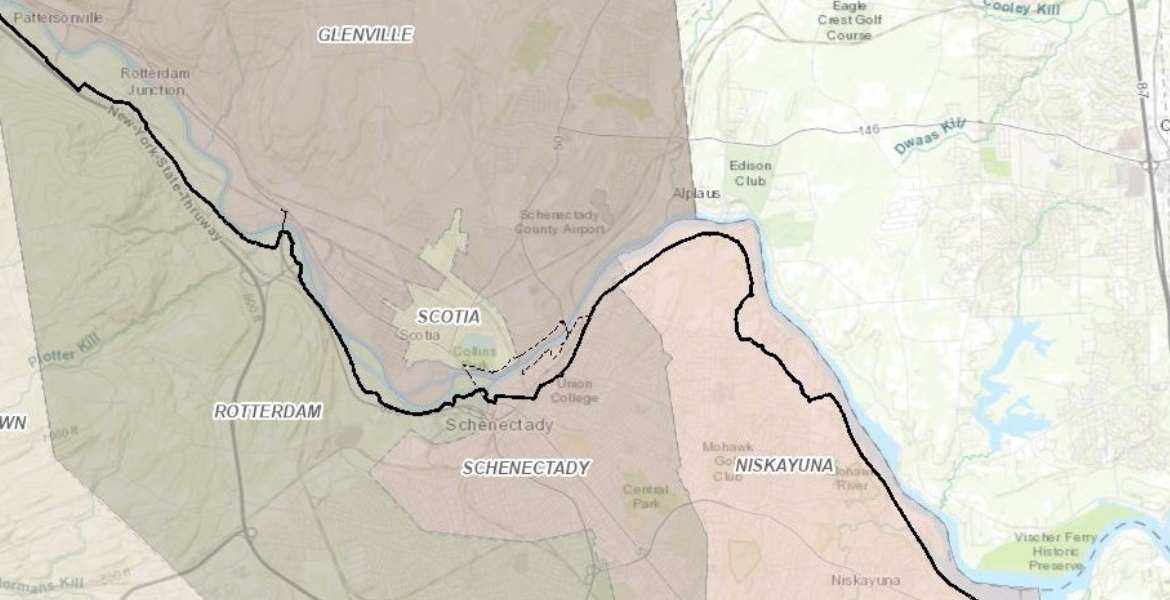
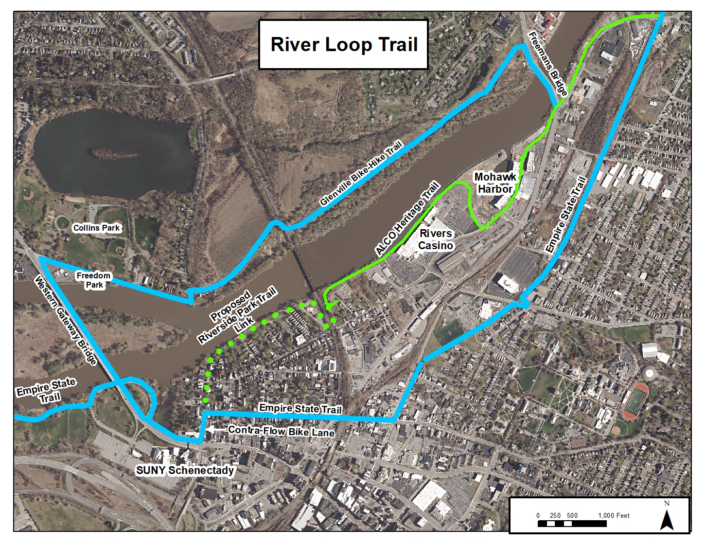
The Empire State Trail in Schenectady County is mostly off-road, with the exception of a brief .75-mile stretch that follows the historic streets of the Stockade Historic District. This neighborhood is one of the oldest in America with homes dating back to the 18th century. Follow the trail through the county or venture just off the trail to enjoy many of the local shops, restaurants, and parks. Enjoy a leisurely 5-mile ride on the Mohawk River Loop connecting Mohawk Harbor to the Village of Scotia's Collins and Freedom Parks.
Top Rated Access Points
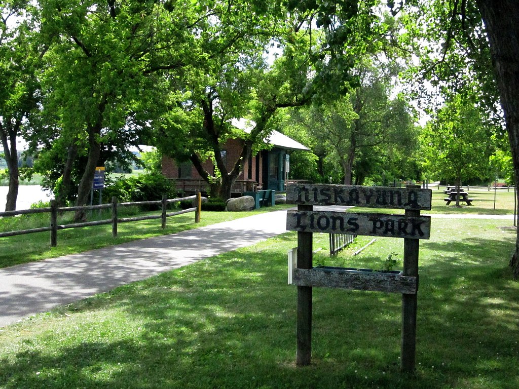
3439 Rosendale Rd, Niskayuna, NY 12309
With its expansive parking, quick access to the Bike Trail, scenic picnic spots, and convenient seasonal restrooms, it's a great place to begin or end your trek on the Empire State Trail. You can also embark on water adventures from the kayak launch and admire the charm of a restored turn-of-the-century train depot. Lions Park offers a seamless blend of history, convenience, and recreation for all to enjoy.
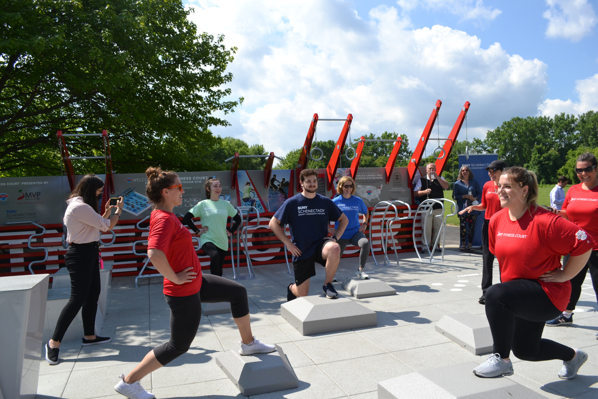
78 Washington Ave, Schenectady, NY 12305
Boasting ample parking, an MVP Health Care Fitness Court, and a bike repair station, it offers seamless trail access. Situated near Downtown Schenectady and the Village of Scotia, the location provides easy reach to restaurants and hotels. Whether for a quick pit stop or a leisurely layover, the SUNY Schenectady Access Point ensures a perfect trailside experience.
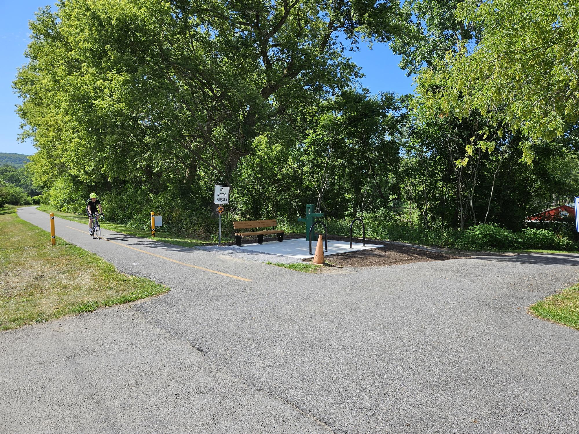
Near 660 River Rd, Rotterdam, NY 12306
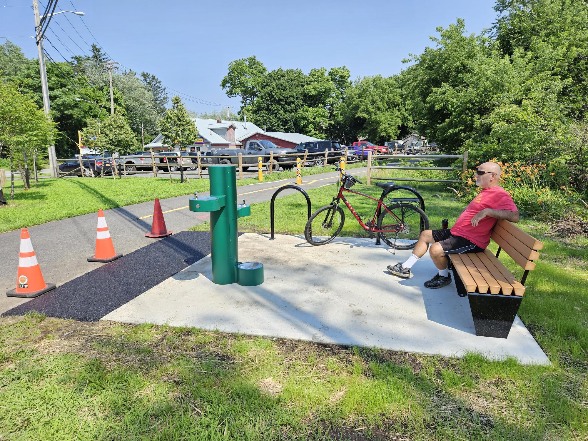
The Kiwanis Park Access Point offers a convenient parking lot, an inviting picnic area, and a boat launch for easy kayak access to the Mohawk River. Excitingly, Schenectady County added a new Bike Trail Rest Stop, enhancing the experience for cyclists. Take a rest, refill your water bottle, and take in some beautiful river views at this trail access point.
Near 1669 Main St, Pattersonville, NY 12137
Discover the perfect pit stop along the Empire State Trail at Pattersonville Trailhead. Nestled off Route 5S at the west end of the County, this haven offers seamless access to the bike-hike trail, ample offsite parking, and park benches to unwind. A newly constructed rest stop, courtesy of Schenectady County, boasts a refreshing water fountain—your perfect respite while exploring this scenic trail.
Discover Schenectady County
The 25-mile stretch of path traverses the entire County and runs through the heart of Downtown Schenectady's business and entertainment district along the historic waterfront. You can access connector trails that will lead you to the Freedom Park Summer Concert Stage, the Village of Scotia's Business District, and the Town of Glenville. There is so much to discover on the trail.
Plan Your Visit or Be a Tourist in Your Hometown. Visit DiscoverSchenectady.com.
.jpg)
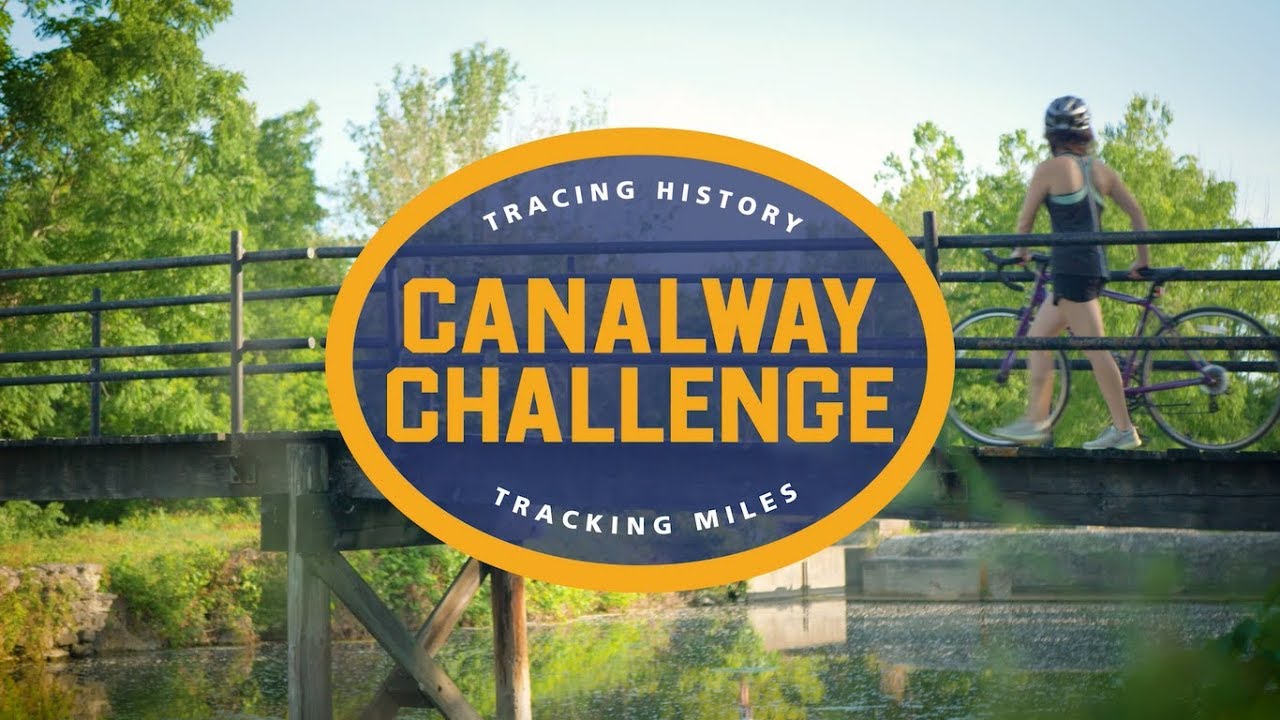
Take the Canalway Challenge
Take your first steps and set your sights on a unique one-of-a-kind adventure presented by the Erie Canalway National Heritage Corridor. Run, hike, or cycle the Erie Canalway, choose your mileage goal, track your miles, and earn your canalway miler sticker. Start your challenge in Schenectady County and go 15, 90, or 180 miles along the Erie Canal. Rack up the regions and explore the entire Erie Canalway as a 360-mile end-to-ender.
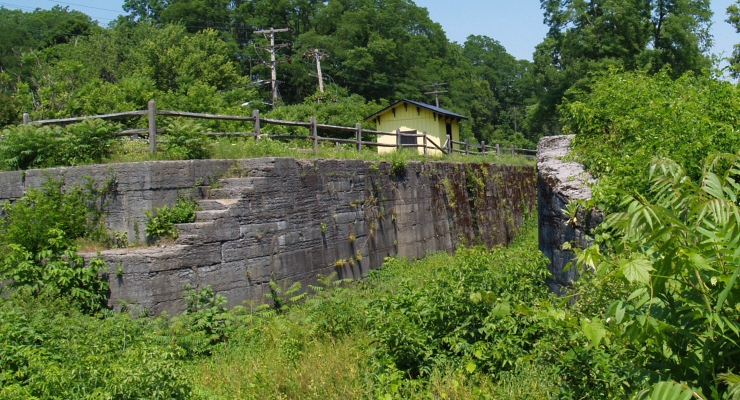
Along the trail, you'll find remnants and artifacts of the old Erie Canal, including Enlarged Erie Canal Lock 23 in Rotterdam and the Rexford Aqueduct near Aqueduct Park in Niskayuna. If you look closely, you might find portions of Clinton's hand-dug ditch, feeder streams, and culverts. Also on your trek, you can watch boats navigate the century-old Erie Barge Canal Locks in Niskayuna and Rotterdam, as well as several movable dams that canalize the Mohawk River.
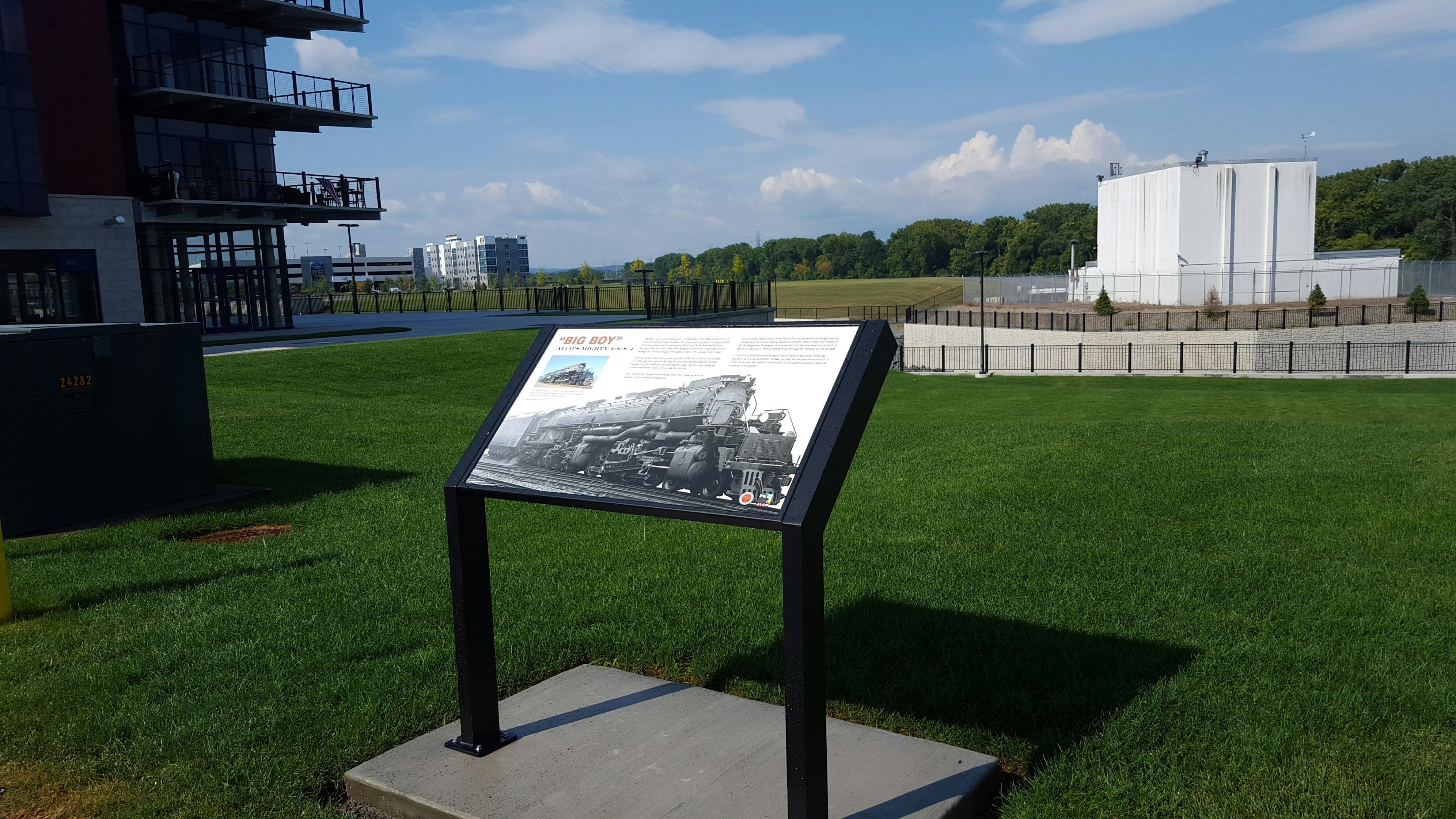
The County recently added the 1.5-mile American Locomotive Company (ALCO) Heritage Trail. This section with a rich history goes through Mohawk Harbor in Schenectady and stretches along the south shore of the Mohawk River between Maxon Road and Schenectady's Stockade neighborhood. From 1847 to 1969, the ALCO plant in Schenectady built some of the biggest and best locomotives the world has ever known and manufactured armored vehicles during World War II. A series of 11 historic signs mark many milestones in the history of the ALCO company and Schenectady. View ALCO Heritage Trail Sign Map
.png)
Schenectady County is always improving. The County's recently completed Mohawk Hudson Bike Trail Extension Feasibility Report. This report forges new paths and maps out improvements and enhancements to existing trails. The plan identifies alternatives to extend the trail with an expanded riverfront trail and reduce the on-road section of the trail to a mere 0.2 miles along Washington Avenue in Schenectady's Stockade Neighborhood. Construction is set to begin in 2024.
Rest Stop & Water Stations
Finding a comfortable place to rest or refill your water bottle on the trail can be tough. With grant funding from the New York State Canal Corporation and the Erie Canalway National Heritage Fund, the County installed two rest areas with water fountains. One rest stop is located at the west end of Schenectady County at the trailhead in Pattersonville. The other is located along the trail near the Towan of Rotterdam's Kiwanis Park.
Rotterdam Railroad Tunnel
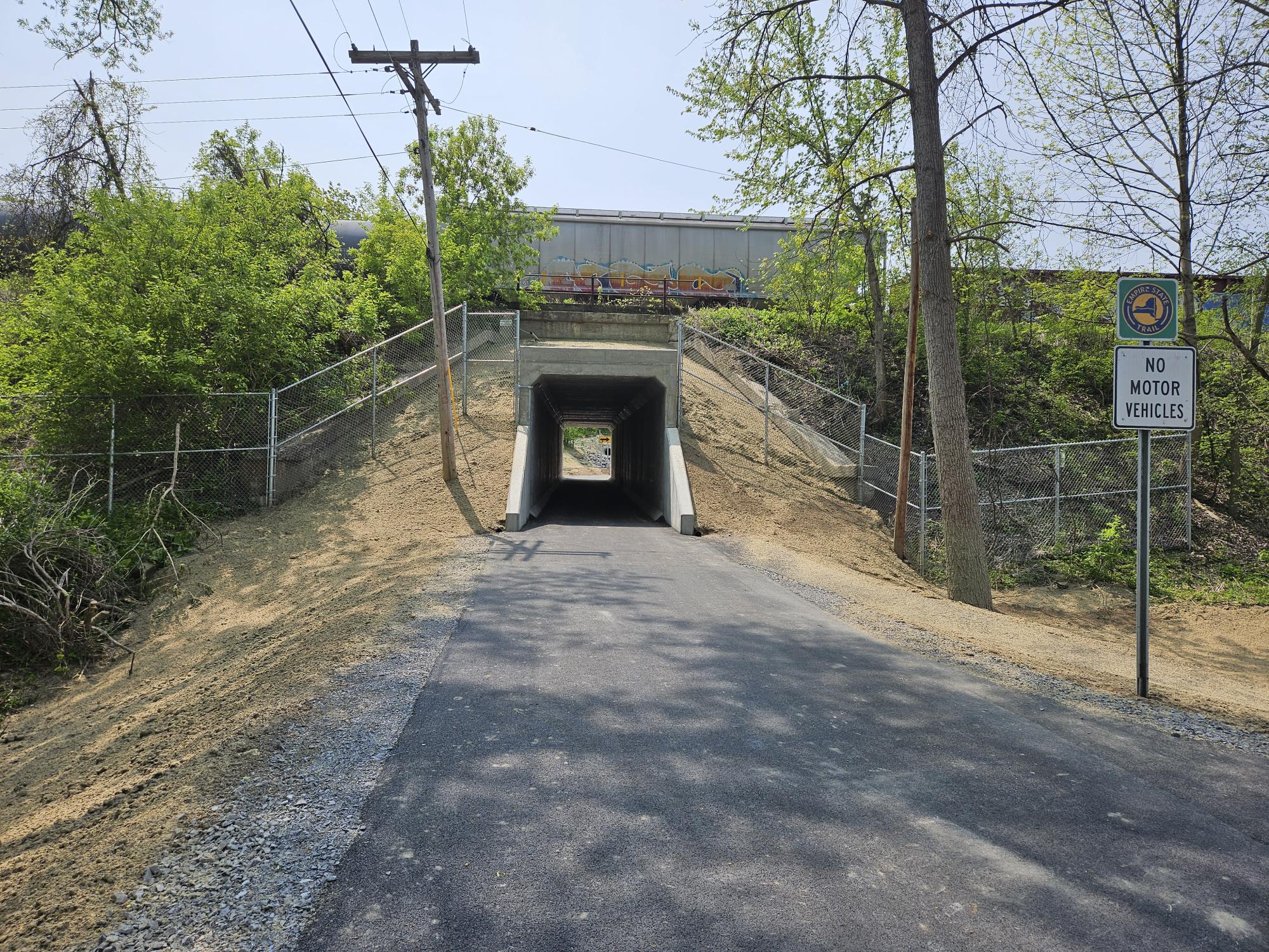
Cyclists on the Empire State Trail in Rotterdam Junction used to face difficulties due to the rail tracks at the end of Leggiero Lane. However, in May 2023, the trail reopened after the installation of a longer tunnel under the CSX Railroad tracks by the County. This improvement will make the path flatter and safer for cyclists and hikers while significantly enhancing mobility.
Washington Ave Contra-Flow Bike Lane

Traveling on a shared roadway with lots of traffic can be stressful, especially near a major intersection. Contraflow bike lanes allow cyclists to ride against traffic on one-way streets. The road is marked by painted lines and symbols that separate bicycles from other vehicles. Look for the completion of the Washington Avenue Contra-Flow Bike Lane in the Fall of 2023. This improvement will enhance the bike trail at Washington and State Street and provide a safer alternative for trail users.
Empire Trail Wayfinding Plan
With the help of 2K Design, Schenectady County completed a Wayfinding Plan for the bike trail. Wayfinding signage is essential in helping cyclists and hikers navigate the path, improving accessibility, attracting more traffic, and promoting safety and a sense of community. A well-designed signage system encourages visitors to explore the surrounding area, giving them the confidence to venture out and enjoy local businesses, restaurants, and parks.
VIEW FULL PLAN
The County's plan offers recommendations for new signage, including:
- Trail etiquette signs to improve safety
- Interpretive signs to showcase the County's rich history and landmarks
- Directional signs to point trail users to nearby dining, shopping, and accommodations
Look Out for New Signs
The County is currently implementing the plan. Look for new and improved signage over the next couple of years.